The Canary Islands are, collectively, one of the finest hiking destinations in the Atlantic region. The terrain ranges from the lunar volcanic surface of Teide — the highest point in Spain — to the primordial laurisilva forests of Anaga and Garajonay, the sheer basalt cliffs of La Palma's Caldera de Taburiente, and Fuerteventura's windswept peninsula. Every island offers walking; several offer world-class routes. These are the ten we would send someone on if they had one chance to hike the archipelago properly.
Teide Summit Trail
Walking to the summit of El Teide at 3,715 metres is the definitive Canary Islands hiking experience — and one that requires both planning and physical readiness. The standard route begins at the Montaña Blanca car park (2,340m) and ascends through extraordinary volcanic terrain: pumice fields, lava flows, and the extraordinary mineral landscape of the upper crater zone. The final 163 metres from the cable car upper station to the actual summit crater requires a separate free permit from the Spanish National Parks system (redreservaspn.miteco.gob.es), which must be booked well in advance — these are limited to 200 hikers per day and regularly sell out months ahead in summer.
Altitude sickness is a genuine risk above 3,000m, even for fit hikers who ascend too quickly. Symptoms include headache, nausea, and dizziness. Acclimatise by spending the previous night at the Parador (2,150m) if possible. The sunrise from the summit — above the clouds, with the other islands visible on the horizon — is one of the most remarkable sights in the Atlantic.
Anaga Rural Park — PR-TF 3 (Cruz del Carmen to Punta del Hidalgo)
The finest long-distance walk on Tenerife winds down from the cloud forest of the Anaga massif to the coast at Punta del Hidalgo — a journey through ancient laurisilva that feels genuinely remote despite being 30 minutes from Santa Cruz. The trail passes through cloud-draped forest of Canarian laurel, giant heather, and tree heath; in the misty mornings the atmosphere is prehistoric. The descent to the coast passes several viewpoints with views of the dramatic north cliffs. Arrange transport from Punta del Hidalgo back to the trailhead (TITSA bus or taxi) before you start. The Cruz del Carmen visitor centre at the start has trail maps and a café.
Masca Gorge Descent
From the village of Masca, the barranco descends 700 metres through a dramatic narrow gorge to a small beach accessible only on foot or by boat. The trail involves loose rock, some scrambling, and several stream crossings; the scenery — towering volcanic walls, dry riverbed, and the occasional glimpse of the sea ahead — is exceptional. The route is one-way only (descent is straightforward, ascent in the heat is punishing and not recommended). Book the return boat from the beach in advance — Masca Boat runs the service back to Los Gigantes. Do not attempt in summer heat without serious water provisions; check trail closure notices, as the gorge occasionally closes after heavy rain.
Roque Nublo Circuit
Roque Nublo — a 67-metre basalt monolith that rises from the central plateau of Gran Canaria at 1,813 metres — is the symbol of the island and the most dramatic landscape feature outside Teide. The circular trail from the La Goleta car park is accessible to anyone with reasonable fitness: a steady climb through pine forest to the plateau, then around the base of the monolith with views across the entire island — on exceptionally clear days you can see Teide on Tenerife. The basalt pillar itself cannot be climbed but walking its full circuit takes about 30 minutes. Combine with lunch in Tejeda (15 minutes by car) for one of the best interior-Gran Canaria days. No permit required.
Caldera de Taburiente Rim Walk
La Palma's Caldera de Taburiente National Park is one of the largest volcanic calderas in the world — a circular mountain basin nearly 10 kilometres across, with walls that rise to 2,400 metres and a floor of ancient lava and pine forest 2,000 metres below the rim. Several rim trails exist; the most dramatic follows the ridge between the Roque de los Muchachos (where the international telescope complex sits) and Pico Bejenado. The views into the caldera from the rim are vertiginous and extraordinary. La Palma requires a flight from Tenerife or Gran Canaria — but the island itself, particularly the Aridane valley and the caldera, is worth the effort. Book accommodation in advance; the island has limited beds.
Camino de la Virgen — El Hierro
El Hierro's Camino de la Virgen traces an ancient pilgrim route from the hermitage at La Dehesa across the Nisdafe plateau to the Ermita de la Virgen de los Reyes — a journey through some of the most atmospheric and least-visited walking country in the Canary Islands. The landscape shifts between the juniper and sabina forests of the south coast, the volcanic badlands of the west, and the fertile plateau in the island's heart. El Hierro's isolation (the smallest and least visited main island) means even this moderately well-marked trail is walked in near-solitude. The island requires a ferry from Tenerife or a direct flight; plan at least three nights to do the walking justice.
Garajonay National Park — La Gomera
Garajonay, a UNESCO World Heritage Site, is the finest surviving example of laurisilva forest in the world — an ancient, cloud-draped woodland that covers 40% of La Gomera's interior. The trees here are the direct descendants of the subtropical forests that covered much of southern Europe and North Africa 20 million years ago before the last Ice Age. Walking in Garajonay in misty conditions — which are common — is one of the most atmospheric experiences in the Atlantic. Several well-marked circular routes depart from the visitor centre near El Cedro; the trail to the summit of Garajonay (1,487m) is 5.5 kilometres each way and offers views across all seven Canary Islands on clear days. La Gomera is reached by ferry from Los Cristianos, Tenerife (50 minutes).
Timanfaya Coastal Volcanic Trail
While most visitors experience Timanfaya from a coach window, a guided walking permit allows access to the interior volcanic trails normally closed to the public — a very different and much more immersive experience. The trails wind through the 1730–1736 lava fields past vent fields, lava tubes, and volcanic formations in extraordinary states of preservation. The guided hike to the Caldera de Santa Catalina is the most popular option. Book through the Timanfaya visitor centre — guided groups are strictly limited and advance booking is essential. Walking the lava field on foot, with a geologist explaining what happened here less than 300 years ago, is significantly more informative than the bus circuit.
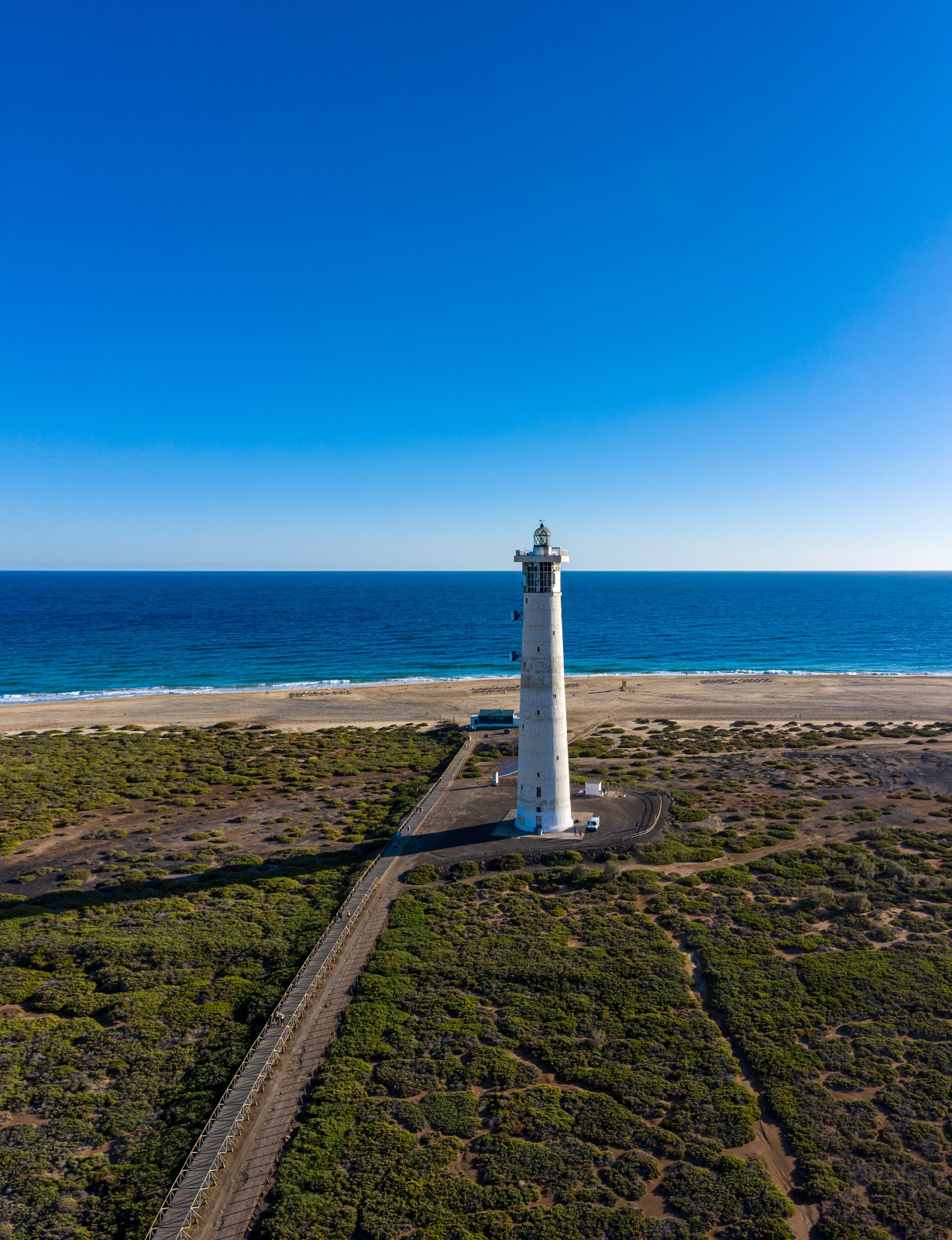
Jandía Peninsula — Punta de Jandía Coastal Walk
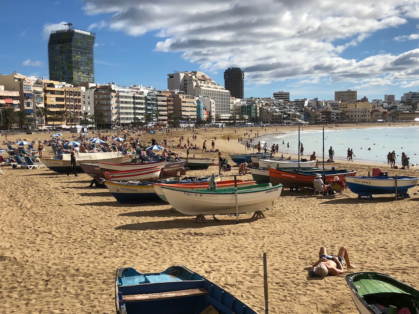
Fuerteventura is largely flat, which makes it an unusual hiking proposition — but the Jandía peninsula on the south coast offers something unique: a long, wild coastal walk with Atlantic views in every direction, past deserted beaches and the occasional military lighthouse, with almost no other walkers. The route from Morro Jable to the lighthouse at Punta de Jandía (the island's westernmost tip) follows the coastal track past the turning for Cofete (the dramatic wild beach — see our beaches guide for the swim warning). Start very early — the sun on the exposed white coastline is relentless by midday, and there is no shade. Carry at least 2.5 litres of water per person.
Barranco del Infierno — Adeje
The one hike on this list that is achievable directly from the south Tenerife resort area — the Barranco del Infierno trailhead is 15 minutes' drive from Playa de las Américas. The canyon trail ascends a dramatic gorge through Canarian scrubland and native pine to a seasonal waterfall, with the resort coast entirely invisible once you are 10 minutes in. The daily visitor limit of 250 people keeps it from feeling crowded. See our full write-up in the Tenerife hidden gems guide. The advance permit booking is essential — do not show up without one.
Browse hotels near Tenerife's hiking areas on Booking.com — Puerto de la Cruz in the north puts you within range of Anaga, Teide, and the Teno massif.
Hiking Essentials for the Canary Islands
What to carry: More water than you think (minimum 1.5 litres per person for short trails, 2.5+ for long ones). Sun protection at all altitudes — UV exposure is high even in winter. A windproof layer for Teide and high-altitude routes; temperatures above 2,000 metres can be 15°C cooler than the coast. Proper walking shoes for anything beyond the easy trails.
Trail marking: Official trails in the Canary Islands are marked with white-and-yellow paint markers (PR routes) or green-and-white (GR long-distance routes). These are generally reliable. Download the Wikiloc or AllTrails track as backup — navigation apps work well in the Canaries.
Emergency: The emergency number in Spain is 112. Many hiking areas in the Canaries have limited mobile coverage; tell someone your intended route and expected return time before setting out on remote trails.
See also: Hidden Gems in Tenerife and Best Things to Do in Lanzarote.